For ADP – Aeróports de Paris – France, CRA created a Universally Accessible Pedestrian Wayfinding System conveyed in French, English, and Spanish.

Charles de Gaulle Airport-Terminal 2C was designated for the prototype. The goal, to direct Passengers with Reduced Mobility
from a sidewalk to the desired reception, was achieved with a multisensory system which can be integrated into new construction or easily retrofitted into existing facilities.

  • pedestrian are accessing the tactile map part of the accessible pedestrian wayfinding system Charles de Gaulle Airport | CRA Design
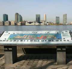
The wayfinding system starts with a multisensoryinformation table to introduces the Terminal.
  • A Raynes rail attached to a tactile map is part of the accessible pedestrian wayfinding system Charles de Gaulle Airport | CRA Design
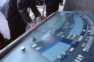
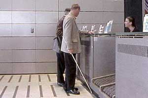
Raynes Rail segments with Braille and audio messagesinform passengers.
  • A visually impaired visitor is using a tactile map part of the accessible pedestrian wayfinding system Charles de Gaulle Airport | CRA Design 
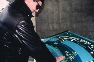
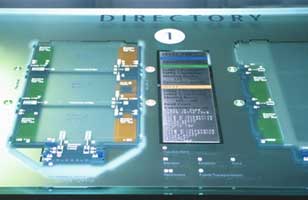
The glass slab present a tactile map of the terminal
  • A Zoom on a tactile map part of the accessible pedestrian wayfinding system at Charles de Gaulle Airport | CRA Design
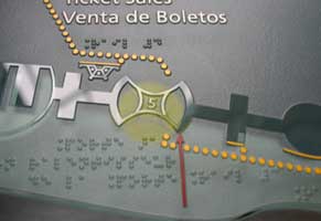
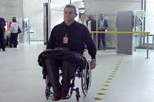
Accessible paths, counters and reserved seating are raised and indicated in yellow.
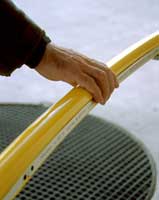
  • Raynes rail with braille part of the accessible pedestrian wayfinding system Charles de Gaulle Airport | CRA DesignAlong the route, handrailsgive sequential information.
  • Zoom on raynes rail part of the accessible pedestrian wayfinding system Charles de Gaulle Airport | CRA Design
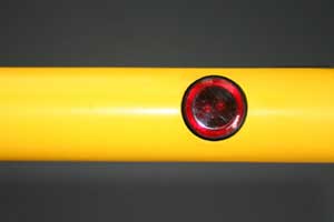
The messages facilitate the navigation of non-sighted travelers through obstacles such as revolving doors.
  • Tacdots: Tactile paving solution part of the accessible pedestrian wayfinding system Charles de Gaulle Airport | CRA Design
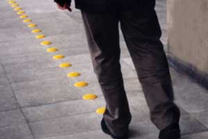
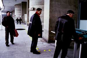
Bright yellow Tacdots delineate the path already introduced on the tactile map.
  • Tactdots: Tactile Paving Solution part of the accessible pedestrian wayfinding system Charles de Gaulle Airport | CRA Design
  • The Tactdots are part of the wayfinding for the visually impaired that helps the visually impaired
  • Another tactile paving solution used by Coco Raynes Associates, Inc. part of the accessible pedestrian wayfinding system Charles de Gaulle Airport | CRA Design

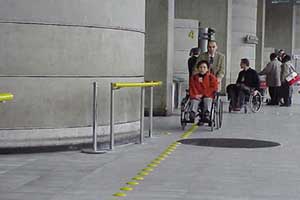
MBTA / RUGGLES ST. STATION

BOSTON, MA

CRA conceived, researched and designed three 2-sided Retrospective Exhibits, which animate the Pedestrian Concourse and depict the history of Roxbury over three centuries.
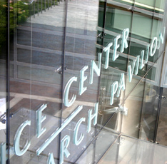
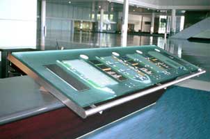
The massive slanted glass slabs are incorporated into the reception desks.

Tactile floor plans raised from the glass surface introduce the main circulation throughout the exhibition complex.

Directory listings with Braille are on changeable metal inserts.

  • The tactile map is part of the accessible pedestrian wayfinding system for the visually impaired in Boston Convention Center | CRA Consultant
  • Zoom on a tactile map part of the accessible pedestrian wayfinding system for the visually impaired in Boston Convention Center | CRA Consultant

617-536-5777